
What are Measured Building Surveys?
Measured building surveys, also known as architectural surveys, are detailed surveys of the internal and external features of a building, including its layout, dimensions, materials, and finishes. The surveys are typically carried out by professional
What are the benefits of having a Measured Building Survey?
A measured building survey is a comprehensive survey of a building’s structure, dimensions, and features. There are several benefits to having a measured building survey, including: Accurate building information: A measured building survey provides accurate
How is a measured building survey carried out?
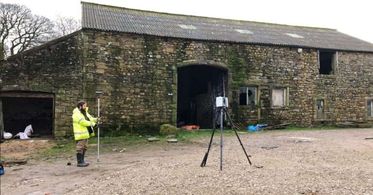
A measured building survey is typically carried out by a professional surveyor, who will use specialised equipment and techniques to obtain accurate measurements and information about a building’s structure and features. The following steps are
What can I expect to receive at the end of a measured building survey?
At the end of a measured building survey, you can expect to receive a comprehensive report that includes detailed information about the building’s structure, dimensions, and features. The contents of the report may vary depending


