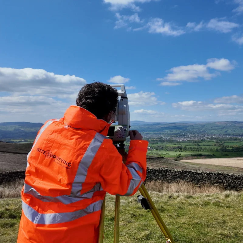
LAND & GEOSPATIAL SURVEYORS LANCASHIRE & NORTH WEST
Specialist land and geospatial survey across the North West. PAS 128 utility mapping. Topographic surveys. Laser scanning. BIM delivery. Programme-critical data, first time.
PROJECTS COMPLETED
14
SURVEY DISCIPLINES
48 hr
QUOTE RESPONSE
PAS 128
QLA ACCREDITED
Land and engineering surveyors based in lancashire, operating nationwide
Site Surveying Services.
Since 1997, Site Surveying Services has grown alongside the dynamic surveying industry. Our use of cutting-edge techniques and technology ensures consistent delivery of high-quality surveys, prioritising exceptional customer service.
Our extensive portfolio features successful topographical surveys, elevations, floor plans, laser scans, and site engineering services. Our measure of success revolves around the value we add to your business, cultivating strong customer relationships and expanding our reach.
We specialise in managing sizable projects while maintaining a personal approach. Our client base spans major construction firms, councils, developers, architects, and homeowners. Regardless of project size, competitive pricing and unwavering commitment to results are guaranteed.
Our team includes skilled surveyors, site engineers, and in-house CAD professionals. Rigorous training keeps them updated with evolving methods and technologies, ensuring efficient site visits and cost-effective results.
Marrying personnel expertise with cutting-edge technology enhances both speed and accuracy, consistently surpassing client expectations. Choose Site Surveying Services for personalised, success-driven, and technologically advanced surveying solutions.
who we work with
Built for the Clients
Who Can't Afford to Get it Wrong.
Technical Directors, Contracts Managers and Highways Engineers at Tier 1 contractors including Morgan Sindall, Costain, Amey and Galliford Try rely on trusted survey partners for highways, civils and infrastructure projects across the North West. As an approved supplier, we deliver PAS 128 utility mapping, topographic surveys and BIM-ready data that integrates seamlessly into your design environment from day one. Our accreditations, proven project delivery and a fast quote response give Technical Directors confidence in defensible data, while Contracts Managers benefit from reliable, zero-hassle delivery on live programmes. Supporting major schemes including United Utilities AMP8 investment and Area 10 A-road and motorway projects, we provide survey-accurate data aligned to your EIR, ensuring your information requirements are met from the outset.
our sectors
Comprehensive Utility Mapping & Topographical Survey – BAE Systems Facility, Barrow-in-Furness
OVERVIEW: As part of a major facility expansion at the BAE Systems site in Barrow-in-Furness, Site Surveying Services was commissioned to deliver a comprehensive utility mapping and topographical survey to support the design and installation of a new on-site car park and associated infrastructure upgrades. This large-scale survey formed a critical foundation for future development, […]
What we deliver
14 Disciplines.
One Specialist Team.
From PAS 128 utility mapping to laser scanning, UAV survey to BIM delivery — all from a single Lancashire-based team.
Our Services.
Topographical Surveys
OS-controlled accurate, efficient and cost effective surveys for highways, civils and development. Cad and BIM-ready output.
PAS 128 utility mapping
Providing the location of underground services in 2D or 3D through qualified utility mapping surveys, using advanced GPR and Electromagnetic Location.
Measured building survey
Delivering accurate as-built information that supports design, refurbishment, planning and construction with the latest technology. Producing reliable drawings and digital models.
Laser Scanning
3D laser scanners capture millions of points per second, creating a point cloud which enables the finer details and the physical site to be viewed remotely.
Mobile mapping
For highway engineers, infrastructure managers, local authorities and contractors working on live road schemes, mobile mapping is now the standard for corridor surveys.
3D Machine control
With decades of supporting major earthworks contractors and large-scale infrastructure schemes, we provide reliable machine control across Lancashire and the wider UK.
Setting out engineers
With strong, long-standing relationships across the civil engineering and construction sector, we supply skilled professionals who keep your projects accurate, efficient and on programme.
bathymetric surveys
Using modern technology, we capture detailed underwater and river channel information safely and efficiently – delivering reliable data you can trust.
Stockpile surveys & volumetric analysis
Whether a one-off stockpile measurement or regular monitoring, we deliver reliable, repeatable data tailored to your project using advanced technology.
Control Network Installation
Delivering robust and precise site control systems to support every stage of construction in developments, infrastructure schemes or major earthworks.
aerial & drone surveys
CAA-approved drone operations for aerial mapping, photogrammetry and volumetric analysis, providing a comprehensive view of terrain, structures and landscapes.
BIM Model creation
Whether you require an as-built Revit model, federated coordination model or detailed digital twin, our team delivers high quality, design-ready outputs.
survey equipment hire
We offer a vast range of surveying and engineering equipment for hire and will always try to beat a comparable quote. Discover the fleet.
monitoring
Providing reliable monitoring surveys across the UK, delivering precise data that supports risk management, compliance and informed decision making throughout a project lifecycle.
Virtual Tour 3D
An immersive experience which instantly transports your clients to your business, guiding them through your space and creating a seamless experience.
Impermeable area surveys
We deliver georeferenced impermeable area data that drainage engineers and planning consultants can work from directly.
CCTV & Drainage surveys
Acoustic & Noise Assessments
We deliver acoustic and noise assessments, supporting planning applications, discharge of conditions and Environmental Impact Assessments.
Why choose site surveying services
On site. On spec. On time.
fast turnaround
Get a quick quote and a survey team prepared for instruction. When the programme window opens, we're ready.
PAS 128 Accredited
British Standard utility mapping. Quality Level B means physical verification of every service - not just surface evidence.
Lancashire-Based
Headquartered in Clitheroe. We know the North West - the sites, the contractors, the programmes. Local knowledge backed by national capability.
Programme-Critical
Data that works in your environment from day one. BIM to your EIR. CAD to your spec. No reprocessing. No delays to the design team.
With all survey disciplines delivered in-house, we maintain full control over quality, coordination, and programme. This removes reliance on third parties and ensures clear accountability at every stage because when delivery fragments, risk increases. Supported by industry accreditations and nearly three decades of experience in high-stakes environments, where delays are scrutinised and failure carries real cost, we provide a standard that stands up under pressure.
We do not aim to meet industry standards. We set them. One team. One standard. One trusted partner.
What do our Clients Say?
We have formed very close relationships with a superb selection of high profile and loyal clients which use our services. Take a look…
Leeds
Doncaster
Sheffield
Bradford
Hull
Halifax
Sunderland
Newcastle
Middlesborough
Yorkshire Moors
Teesside
Cumbria
Harrogate
York
Yorkshire Dales
Goole
Carlisle
Keswick
Kendal
Barrow-in-Furness
Lancaster
Blackpool
Morecambe
Southport
Liverpool
Wigan
Manchester
Blackburn
Burnley
Forest of Bowland
Oldham
Chester
Stockport
Peak District
Skipton
Crewe
Rotherham
Stoke
Driffield